| < Previous page | Next page > |
Watershed DelineationWatershed Delineator
NetMap Module/Tool: Analysis Tools/Watershed Delineator
Model Description:
This tool is used to delineate upstream drainage areas, as polygons, by selecting one or more reach segments. The tool works from downstream to upstream, thus, when two or more segments along a stream are selected, the lower selected segment-watershed will not overwrite the upper, but rather it will select the drainage area between the two. Once you have created custom subbasin polygons, then a user could run the Sort and Rank or the Cumulative Distributions tools, or use the upstream-downstream aggregation tool to define various watershed attributes above stream segments of interest.
Use of the tool is shown in Figure 1. A user either delineates watersheds using selected reaches (1) or provides points (a point shape file, 6). Rough pixelated edges along the polygon can be smoothed (2). Watersheds are delineated (3) and shown in the display (4). Polygons are named and can be retrieved at a later date (5). If a point shape file is used (6), it must be selected from the drop down list (7) along with the attribute name (8); the FID is the default.
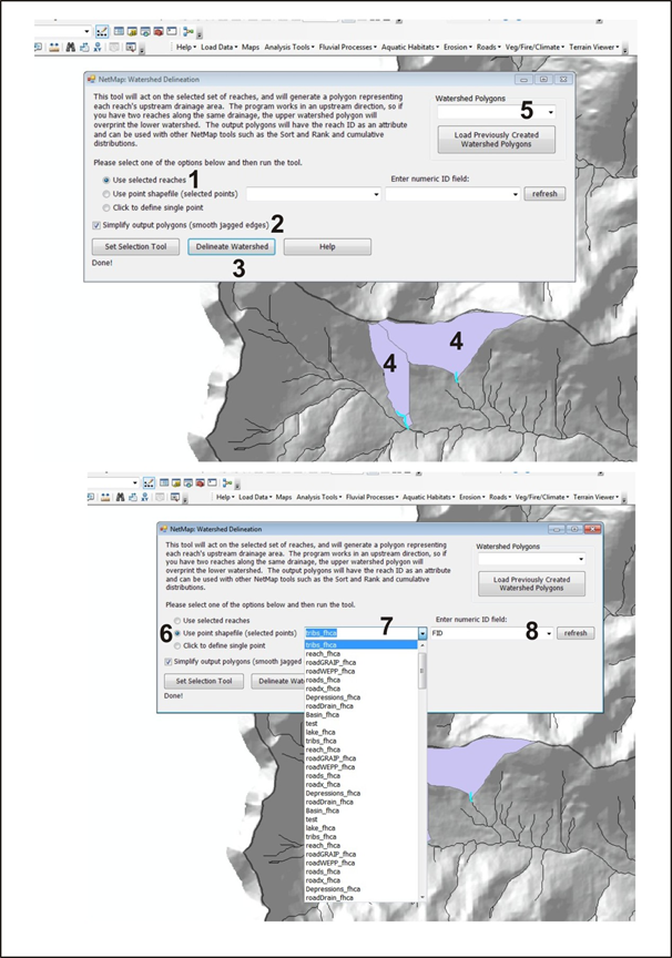 Figure 1. NetMap's watershed delineation tool.
|