| < Previous page | Next page > |
Floodplain/Valley Floor-UpwellingFloodplain/Valley Floor Upwelling - Provisional Cool Water Refugia
Tool Description: This tool searches for locations in a watershed where floodplains, terraces or valley floors become constricted, leading to the conditions favoring upwelling (Edwards 1998).
Data Type: Line (stream layer)
Field Name: FPchg; Common Name: Floodplain Difference.
Units: meters
NetMap Module/Tool: Vegetation/Fire/Climate - Vegetation - Shade/Stream - Thermal Refugia - Floodplain-Upwelling.
Model Description: This tool searches for downstream narrowing in floodplains (or terraces, or higher valley floors). Where sigificant narrowing occurs, hyporheic flow upwelling can occur, which can lead to cooler waters merging into the stream flow (Figure 1). Conversley, where floodplains abruptly expand, downwelling can occur.
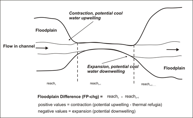 Figure 1. Floodplain expansion and contraction can promote the upwelling of cooler water and the downwelling of water. Note, the width of floodplains, terraces or valley floors must first be calculated using NetMap's Floodplain Tool. Floodplains are generally mapped at 2x (e.g., two times bankfull depth) although terraces and higher elevation valley floors can also be used (by using > 2x, such as 3x, 4x, and 5x etc.). The "Floodplain Difference" parameter is calcuated by subtracting the downstream floodplain width (reach attribute) from the next upstream width value (see Figure 1). Positive values denotes a width contraction and thus the potential for upwelling and cooler water conditions (refugia) while negative values denotes a width expansion and thus potential downwelling. See examples below.
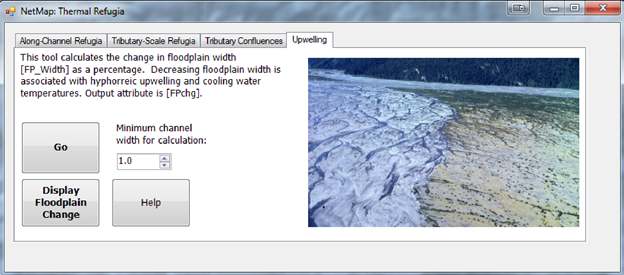 Figure 2. NetMap's floodplain upwelling tool searches for downstream, reach to reach, contractions or expansions in floodplains, terraces or higher elevation valley floors. Note, that NetMap's Floodplain Tool must be used first to calculate floodplain, terrace or higher elevation valley floors (NetMap datasets generally come with a 2x floodplain (reach attribute and a polygon).
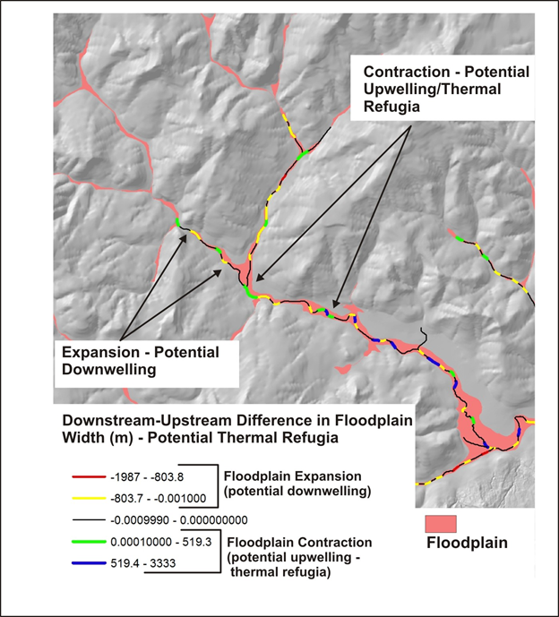 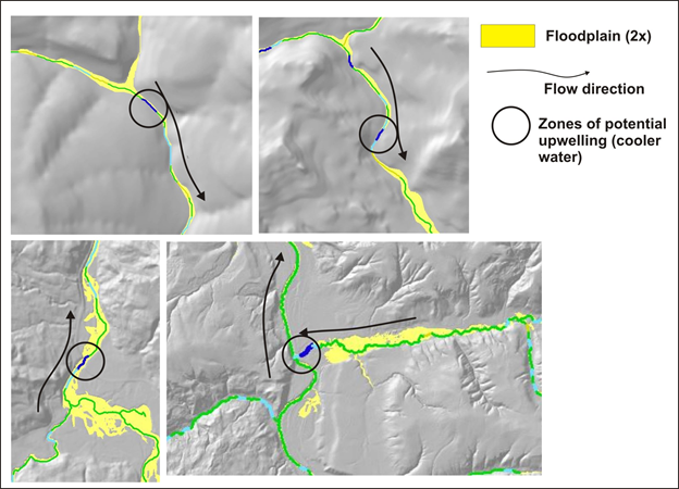 Figures 3 and 4. Examples of floodplains at 2x expansions and contractions and thus denoting the locations of provisional upwelling and downwelling areas.
|