| < Previous page | Next page > |
Channel DepthChannel Depth (Bankfull)
Parameter Description: Bankfull channel depth typically predicted by statistical regressions. Users can customize their depth predictions using their own regressions (Subscription only).
Data Type: Line (stream layer)
Field Name: DEPTH_M; Common Name: Bankfull depth
Units: Meters
NetMap Module/Tool: Fluvial Processes/Hydrualic-Planform Geometry
Model Description:
In NetMap, statistical regressions are used to predict bankfull channel depth (Figure 1). Banfull channel depth (m) is modeled as a power function of mean annual flow, drainage area and or precipitation; see Leopold and Maddock 1953 and Clarke et al. 2008. Channel bankfull depth is used in numerous applications in NetMap, including in the prediction of flooplains.
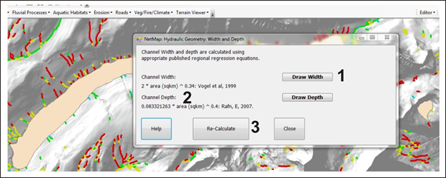 Figure 1. In the Channel Depth interface, users can display the depth (1) using the default regression that was used (2), or users can re-calculate channel depth using their own regressions (Figure 2).
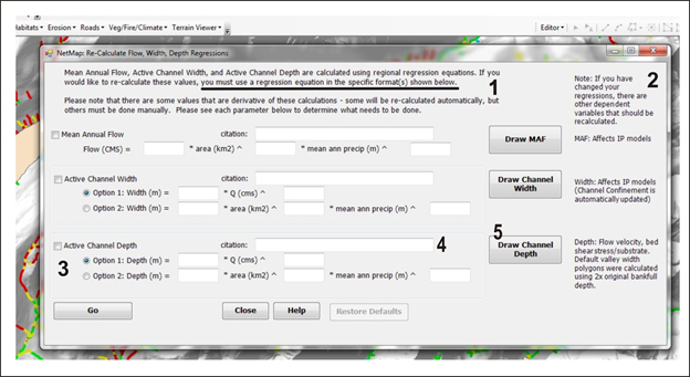 Figure 2. Users have the option of customizing the prediction of channel depth (1), although the form of the regression equation used must follow specific formats; the cutomization option requires a NetMap subscription. If channel depth is modified, there are several other parameters that need to be recalculated, some automatially and others needing to be done manually by the user (2); for example, floodplain width will be effected. An analyst inserts their own custom regressions using the equation forms provided (3). A citation can be added (4). And results can be displayed (5), Figure 3.
Precipitation data is from PRISM (http://prism.oregonstate.edu) data on annual precipitation and the use of one or more regression models; refer also to Lorensen et al. (1994) and Clarke et al. (2008).
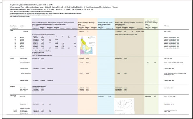 Figure 2. NetMap contains a table of readily availabe flow regression statistics from which users can create their own predictions of flow measures, such as depth. Analyst are encourage to use landscape specific regressions or to create and apply their own.
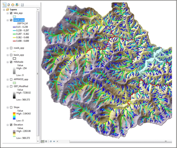 Figure 3. Channel depth is important for assessing various attributes of watersheds including mapping floodplains.
|