| < Previous page | Next page > |
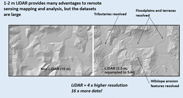
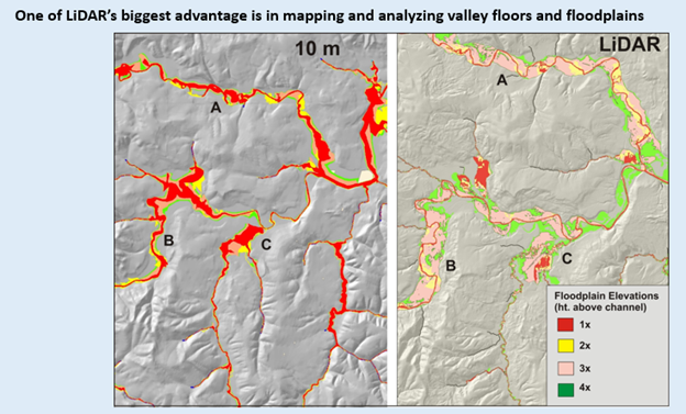
Virtual Watersheds: LiDAR AdvantagesThere are significant advantages in using LiDAR based NetMap virtual watersheds. Although many of the new NetMap datasets (2017/18) are LiDAR based because of the increasing availablility of LiDAR across the western United States, Canada, Alaska and the EU, many existing NetMap datasets are use 10m resolution DEMs.
To see the advantages of LiDAR, go here.
  |