| < Previous page | Next page > |
Google EarthGoogle Earth, Fly in and Export Data
Description: A user can fly from any specific location in NetMap’s Digital Hydroscapes to Google Earth or they can export any part of NetMap digital watershed data to Google Earth.
NetMap Module/Tool: Analysis Tools
Model Description:
This NetMap tool allows a user to “fly” from any point in NetMap’s Digital Hydroscapes in ArcMap to Google Earth. The projection has to be consistent with Google Earth although NetMap databases should be in the correct projection for export. Data are exported using the current color-coded legend and it is shown in Google’s “Places” window on the left side.
It is recommended that a subset of objects (for example fish habitat potential or debris flow potential) be selected rather than the entire network using the Arc select tool, this will ensure more rapid transfer of data (Figure 1) If a subset is not selected, the entire database will be exported. For very large NetMap watersheds, this could be time consuming and may even make Google Earth choke or crash. The user is flown into the appropriate Google Earth image (Figure 1).
If a grid is exported, the selection is limited to the current display window (Figure 2). At present the maximum window size for exporting grids (such as landslide density, fire risk, burn severity etc.) is 15 km (horizontal across screen distance). If a larger image size is exported, a message will indicate that a smaller area is required. Other data, such as road drainage diversion or road surface erosion can also be exported (Figure 3).
Export files are stored as: [drive]:\work\netmap\google\filename.kml. Note that filename.kml files can be shared with others. When someone clicks on a _.kml file, Google Earth automatically opens and the user is flown into the appropriate Google image with the draped NetMap data.
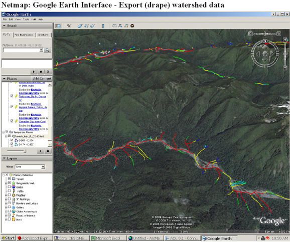 Figure 1. NetMap’s Google Earth interface tool allows a user to export (and drape) NetMap digital watershed attributes onto Google Earth images. Data are selected from a drop down list. Next, the user selects the type of object to export. This includes tribs_, reach_, roads_, roadx_, basin_, hillshade, erosion (grid), erosion delivery (grid), slope (grid), and elevation (grid). One can confirm the type of file by looking at ArcMap’s legend for the map display in question.
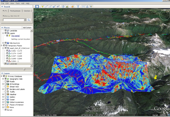 Figure 2. NetMap’s Google Earth tool is used to juxtapose steelhead habitat (reach, channel colored segments) in the Hoh River basin in western Washington with predicted shallow landslide potential (grid). This allows analysts to examine, visually, spatial overlaps between areas of high erosion potential and important and sensitive fish habitats.
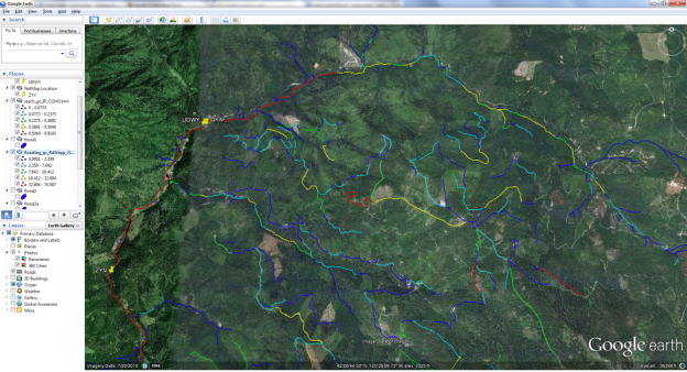 Figure 3. Predicted road surface erosion (WEPP) is draped on Google Earth imagery in this example in southwest Washington.
|