| < Previous page | Next page > |
Drainage AreaDrainage Area (Channel Segment)
Parameter Description: The drainage area of the watershed located above each channel segment.
Data Type: Line (stream layer)
Field Name: AREA_SQKM; Common name: Drainage Area
Units: Square kilometers
NetMap Module/Tool: Fluvial Processes/Network Variables
Model Description
Drainage area is one of the outputs from NetMap. Based on flow accumulation, drainage area is the sum of all pixels located upstream of every delineated channel segment. Channel drainage area is included as a standard NetMap parameter and a stand-alone model is not required.
Drainage area is an important attribute in estimating characteristics such as channel width, discharge, stream power and fish habitat. Predicting drainage area requires calculating flow accumulation using a digital elevation model (Figure 1).
Technical Background: na
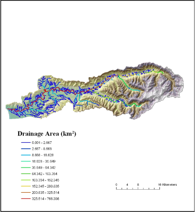 Figure 1. Drainage area is important for interpreting channel types and other aquatic parameters
and it can also be used to classify aquatic habitats.
|