| < Previous page | Next page > |
6.6 Habitat Upstream of Road CrossingsRoad – Upstream-Downstream Habitat (e.g., Habitat Length and Quality Above [or below] Stream Crossings)
Parameter Description: NetMap’s tool calculates the cumulative distance and average (or summed) habitat quality for various fish species above all road crossings in a watershed.
Data Type: line (reach)
Field Name: Upmean; Common name: Upstream Mean Value
Field Name: Uplength; Common name: Upstream Length
Field Name: Upsum; Common name: Upstream Summed Value
Units: Upmean -mean of habitat scores (see individual habitat models); Uplength - sum of length of habitat (km); Upsum - sum of habitat scores (see individual habitat models)
NetMap Module/Tool: Roads
Model Description:
NetMap has the ability to summarize information in stream reaches (as well as on hillslopes, drainage wings and buffers, see Tool) both upstream and downstream. In this version of the tool, a user can calculate the cumulative habitat length, average quality and summed quality, above all road crossings. This type of data analysis may be useful for strategically planning road surveys or road restoration efforts including improving fish passage at road crossings
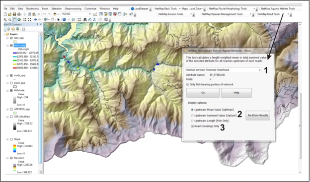 Figure 1. In the Roads Module, a user locates the tool for predicting the cumulative habitat length, mean value and summed value (species specific) above all road crossings in a watershed.
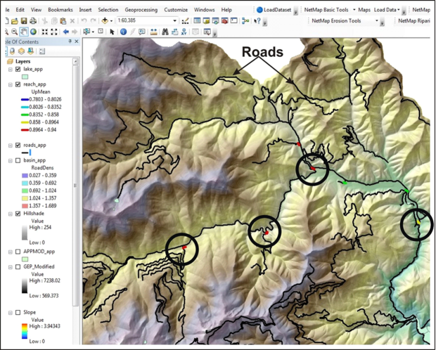 Figure 2. Shown is the display for average habitat quality (steelhead) above all road crossings.
The contents of 6.6 Habitat Upstream of Road Crossings |