| < Previous page | Next page > |
Priority SearchPriority Search (Risk Analysis)
NetMap Module/Tool: Analysis Tools/Risk Analysis
NetMap is used to conduct different types of risk analyses that involve identifying the spatial juxtapositions between predicted hazards (erosion, flooding potential, wildfire risk etc.) and sensitive and valuable aquatic resources. One NetMap tool that analysts can use to search for the highest to lowest values of any particular attribute (but not rasters) is called "Priority Search".
Priority Search
Model Description:
NetMap calculates the full cumulative distribution of any attribute in the Virtual Watershed datasets and thus a user can quickly search for and locate any specified portion of the distribution, such as the highest 1%, highest 5%, or highest 10% etc.
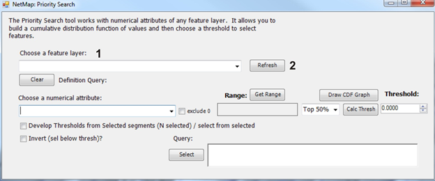 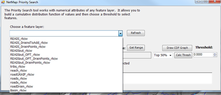 Figure 1. The Priority Search interface. A user selects a feature layer from the drop down list (1), showing all non raster layers in ArcMap's table of contents. If new layers are added, use the "refresh" button to have them show up in the list.
 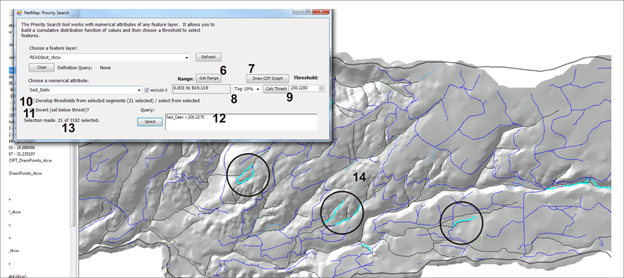 Figure 2. A user then selects an attribute from the drop down (3). If attribute values include zeros, you can exclude those since they will affect the priority search (4). One can get the range of values for the attribute (6), which will not be affected even if zeros are excluded. The full CDF plot can be displayed to help one select a numerical threshold to search for (7). Select from the drop down of percentile (highest 20%, highest 5% etc.). A user MUST calculate the threshold (9) which is then shown in the threshold window. The search can only be conducted on a subset of features (11) and if not checked, all features will be part of the analysis. After pressing "Select" (12) the selection criteria is displayed in the window. The number of features selected is displayed (13) and the selected features are highlighted in the map (14).
|