| < Previous page | Next page > |
Resolution Differences in Stream Layers: 30m Versus LiDARThe resolution of digital elevation models (30m, 10m, LiDAR) has a strong influence on the fidelity of the resulting stream layer (of course the model algorithm chosen is also very important) (Mouton 2005). When moving between large differences in resolution (30 m to 2m LiDAR), the differences in channel extent and location are significant (Figure 1).
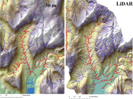 Figure 1. A comparison between stream networks derived from 30 m and 2 m LiDAR in southeast Alaska. The river network extent is much more developed using the 2 m LiDAR
The differences between these two resolutions in terms of drainage density can be significant (Figure 2).
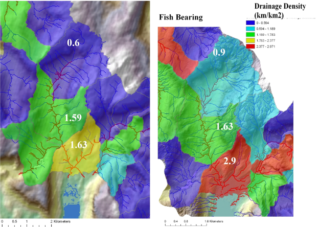 Figure 2. The predicted drainage density is greater in the 2m-LiDAR DEM (right panel) compared to the 30 m DEM (left panel). The disparity is mostly in the headwaters, with the LiDAR dataset having a much higher headwater drainage density. However, if the fish bearing network is of primary interest, then coarser DEMs may reasonably reflect the actual density of fish bearing streams.
|