| < Previous page | Next page > |
5.1 Hillslope GradientHillslope Gradient
Parameter Description: Hillslope gradient is calculated from digital elevation models using
A Langrange polynomial as described in Zevenbergen and Thorne (1987). Radius over which the polynomial is fit is an adjustable parameter. Surface gradient is calculated for each DEM cell using Lagrange polynomials to fit a surface over an area of specified radius (25 m). The equations presented in Zevenbergen and Thorne, 1987 (Earth Surface Processes and Landforms, V12, p47-56) are used, modified for use over a circular area (e.g., Shi et al., Photogrammetic Engineering & Remote Sensing, V73, p 143-154). To remove bias in gradient calculations arising from the DEM grid alignment, the surface fit is applied twice, once aligned with the DEM grid and again offset by 45 degrees. The average of the two gradient calculations are given in the SLOPE raster. The slope raster provided with NetMap has gradient calculated from a 10-m DEM using a radius of one cell length, giving a total length scale over which gradient is calculated of 20 meters.
Data Type: Line (stream layer)
Field Name: Slope; Common name: Hillslope gradient
Units: L/L
NetMap Module/Tool: Erosion
Model Description:
Hillslope gradient is calculated from digital elevation models (commonly 10-m DEMs) and displayed as rise over run (Figure 1). Hillslope gradient in NetMap is used primarily in calculations involving erosion potential including shallow landslides, debris flows, and gully erosion.
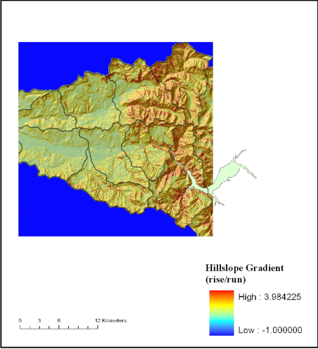 Figure 1. Hillslope gradient in calculated from digital elevation models, commonly 10m scale in NetMap datasets.
|