| < Previous page | Next page > |
Mean Annual PrecipitationMean Annual Precipitation-Channel
Parameter Description: The dmean annual precipitation as reflected in the stream channels (routed from drainage wings).
Data Type: Line (stream layer)
Field Name: MNANPRC_M; Common name: Mean annual precipitation
Units: meters
NetMap Module/Tool: Fluvial Processes/Network Variables
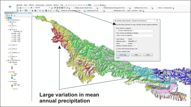
Model Description
on Mean annual precipitation is obtained from PRISM. It is transferred to stream channels, via Drainage Wings. It can be used to display the variation in precipitation across a watershed and landscape (Figure 1) and it is used in predicting mean annual flow.
drainage area is the sum of all pixels located upstream of every delineated channel segment. Channel drainage area is included as a standard NetMap parameter and a stand-alone model is not required.
Drainage area is an important attribute in estimating characteristics such as channel width, discharge, stream power and fish habitat. Predicting drainage area requires calculating flow accumulation using a digital elevation model (Figure 1).
Technical Background: na
 |