| < Previous page | Next page > |
Longitudinal ProfilesLongitudinal Profiles
NetMap Module/Tool: Analysis Tools/Profile Graphs
Model Description:
The tool, used in the office or in the field, allows users to quickly display longitudinal profiles of any stream segment attribute in NetMap. A user first selects an attribute and then clicks to load the tool, and selects one reach. The profile is calculated upstream from that reach, for a distance indicated by the user or until the end of the analytic river network ends. Once an attribute is plotted, a user has the option (a dialogue box will pop up) to display other attributes along the profile.
Use:
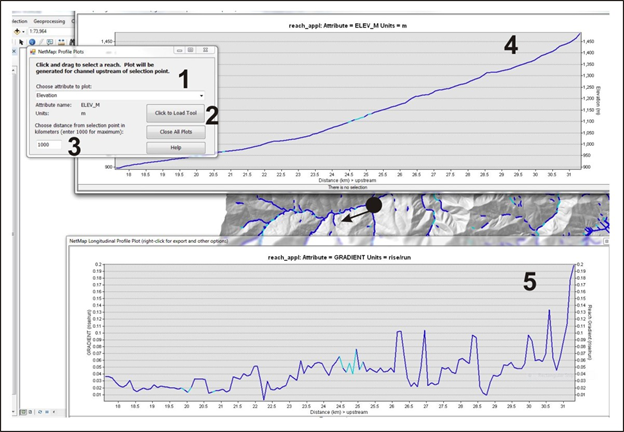 Figure 1. (1) A user selects an attribute to plot. (2) The tool is loaded, and a single segment is selected. (3) A distance upstream is indicated (in kilometers). If the distance is greater than the actual length of the channel, the plot will encompass the entire channel to the headwaters. Shown is a longitudinal plot of elevation (4) and another plot of gradient (5). Multiple attributes can be plotted for a single selected channel. The color legend in the channel reaches will be displayed on the longitudinal plots (5).
|