| < Previous page | Next page > |
LOAD-DATALoad Data
Parameter Description: na
Data Type: Digital Hydroscape databases (also referred to as "digital watersheds" or simply as "datasets").
Name: Differentiated by Hydrologic Unit: Watershed name
Units: na
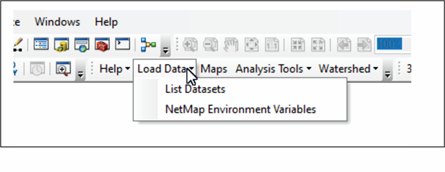
NetMap Module/Tool: Load Data in Master Tool Bar
Model Description:
In NetMap individual watersheds are selected and loaded. From the master tool bar, Click on "Load Data" and choose from list to locate watersheds of interest (Figure 1). A watershed or group of watersheds in a single NetMap dataset will range in size from approximately 200,000 to 400,000 acres (300 –600 mi2, 800 – 1,600 km2). Watersheds are obtained from the data catalogue using the website (www.terrainworks.com) (or can be snail mailed to clients).
Step 1: From the NetMap tool bar, click on "Load Data". Note the "NetMap Environmental Settings"; refer to either "Get Started" or the "Environmental Settings" Help. Selecting from the list opens another interface (3) from which a drop down list of NetMap datasets is displayed, indexing the datasets (4) located on a users hard drive.
 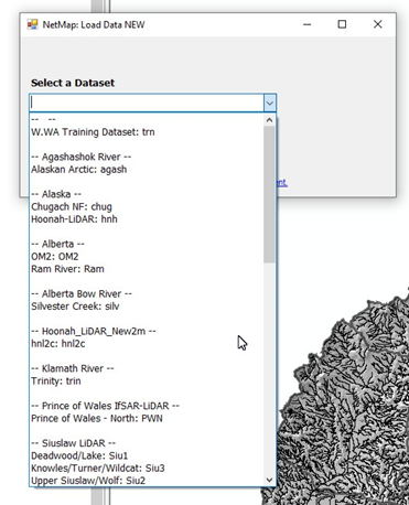 Then simply select the right dataset and load in ArcMap.
Once loaded, one should define a fish distribution. NetMap differentiates channel networks into fish bearing and non-fish bearing streams. This is primarily for the purpose of map display where a user may only wish to display, for example, channel gradients on larger fish-bearing streams, or where a user may wish to conduct an analysis (such as calculating drainage density) only on fish bearing channels. Because of the dominance of small first- and second-order headwater channels in a watershed, the overall proportion of fish bearing channels may be small (40% or less).
The contents of LOAD-DATA |