| < Previous page | Next page > |
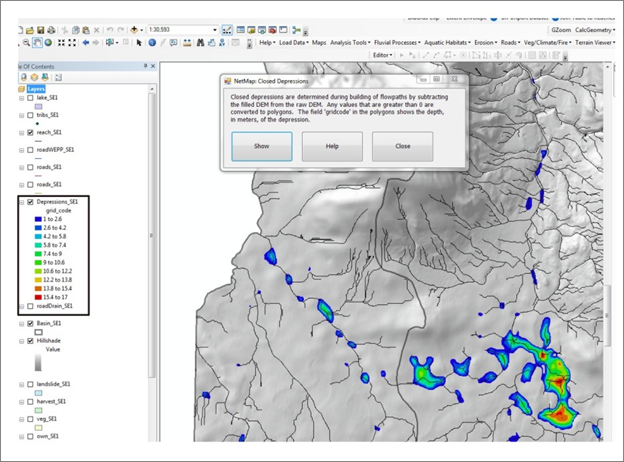
3.10 Closed DepressionsClosed Depressions
Parameter Description: Topographic depressions in the landscape, defined by elevational contours indicating depth.
Data Type: Polygons
Field Name: depressions_dataset name; Common name: Depressions
Units: Contours in meters
NetMap Module/Tool: Fluvial Processes/Closed Depressions
Model Description:
During creation of the analytic stream layer, depressions in the DEM are filled to enable flow routing from one grid cell to another; the accumulation of flow leads to channel networks. The "closed depressions" may be actual features in the landscape or they may be artifacts of the DEM. Larger depressions (such as large lakes, wetlands, bogs, muskeg etc.) are typically included in the NHD "lake" layer, data typically included in a NetMap dataset. Actual closed depressions (not included in the NHD lake layer) could indicate areas such as wetlands or bogs (previously unidentified).
 |