| < Previous page | Next page > |
Cumulative Downstream AggregationCumulative Downstream Aggregation
Parameter Description: Any hillslope (raster, e.g., fire risk, vegetation age, erosion potential etc.), at the scale of drainage wings or a portion thereof encompassed within a stream-adjacent buffer or any channel reach attribute can be aggregated (summed and area weighted) downstream. For example, a user can calculate the downstream cumulative average, sum or length of fish habitats and a user can define these attributes above every single road crossing (the latter is a stand-alone tools in the Road Analysis Module. See NetMap’s Upstream Aggregation Tool.
Data Type: Line (stream layer)
Field Name: UpLength; Common Name: Cumulative Downstream Length
Field Name: UpMean; Common Name: Cumulative Downstream Mean
Field Name: UpSum; Common Name: Cumulative Downstream Sum
Units: variable
NetMap Module/Tool: Base Tools/Downstream Aggregation (also located in the Road Analysis Module for road specific applications and in the Aquatic Habitat Module/Upstream Habitat)
Model Description:
This tool calculates the cumulative upstream (and downstream) properties (e.g., upstream or downstream of every segment in a river network) including the mean, sum and average for any NetMap parameter (Figure 1). For example, the cumulative upstream habitat length is calculated for each stream segment within the defined fish-bearing network (Figure 2) or the cumulative upstream habitat quality (average) (Figure 3). The cumulative upstream habitat measures are species specific and they are based on the defined fish bearing network. Thus, the upstream length of habitat for coho salmon will likely be less than the upstream distance of habitat associated with resident fish. The cumulative upstream attribute tool is also used in NetMap’s Road Tools where habitat length, sum or mean quality can be calculated upstream of each road crossing (see Road Analysis Module).
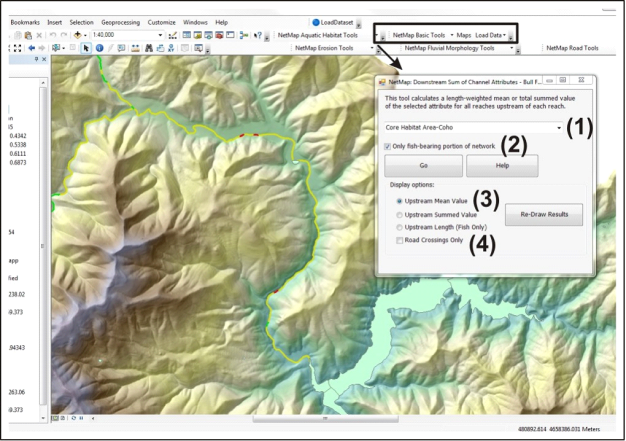 Figure 1. NetMap’s cumulative upstream (or downstream) aggregation tool allows users to calculate upstream (and downstream) mean values or summed values. (1) A user selects an attribute; the entire network or only the fish bearing portion (2) is chosen for analysis. (3) The type of aggregation is selected. The tool can be run for road crossings only (4).
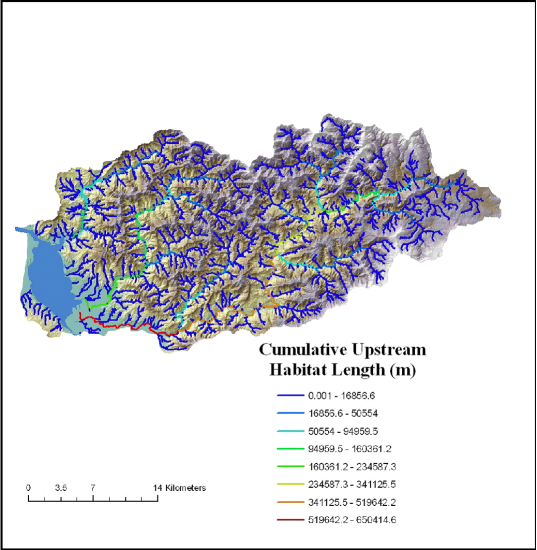 Figure 2. NetMap calculates the cumulative upstream habitat length for each and every segment in the defined fish bearing network.
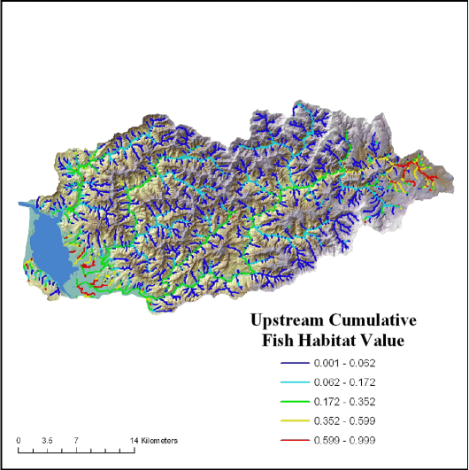 Figure 3. NetMap calculates the cumulative upstream mean habitat value for each and every segment in the defined fish bearing network.
|