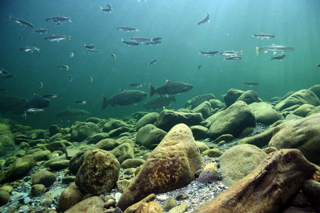
Thermal Refugia within streams is important for certain aquatic life, including endangered fish species such as salmon and trout. Thermal refugia is particularly important in watersheds that have less than optimum shade conditions because of historical and current land use including forestry, agriculture and urbanization. In addition, climate change that decreases summer stream flow or increases stream temperatures can exacerbate warm water conditions, making thermal refugia even more important.
Thermal refugia is best determined by field surveys of stream temperatures in the summer, but obtaining temperatures at the watershed scale can be expensive and time consuming. Another method is airborne thermal remote sensing which requires aircraft (fixed wings or helicopters) to fly over sections of rivers and document water temperature (
Torgersen et al. 2001). Airborne thermal remote sensing holds great promise to obtain actual water temperature conditions, including identifying thermal refugia, however, it continues to be difficult (and expensive) to apply at the scale of large watersheds, landscapes and states.
Another approach is to use intrinsic landscape conditions on thermal loading to streams, combined with current shade conditions, to map potential thermal refugia. NetMap contains a tool to map four types of thermal refugia:
1) along channel (reach scale),
2) along channel (tributary scale),
3) confluence intersections with mainstems, and
4) floodplain upwelling.
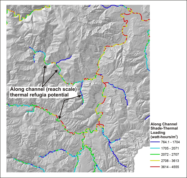
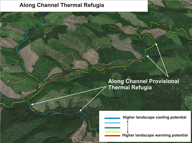
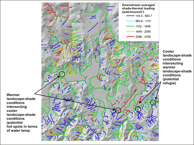
Type 1: Along-Channel, Reach Scale
Figures 1 and 2. Examples of along-channel, reach scale thermal refugia (provisional).
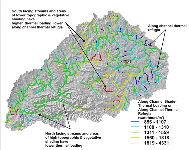
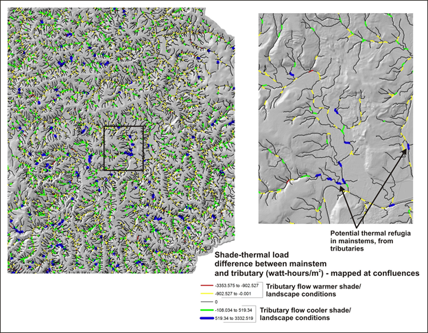
Type 2: Along-Channel, Tributary Scale
Figure 3. Tributary scale thermal refugia.
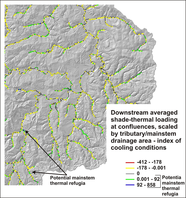
Type 3: Confluence Related
Figure 4 (left panel) shows the differences between the downstream aggregated values of Shade-Thermal Energy between tributaries and mainstems (e.g., mainstem value - tributary value); positive values means that a tributary has, in aggregate, more inherent landscape and shade cool water conditions compared to a mainstem while negative values means that a tributary has, in aggregate, more intrinsic landscape and shade warmer water conditions compared to a mainstem.
Figure 5. shows the same values as Figure 1 except they are multiplied (at confluences) by the ratio of the tributary drainage area to mainstem drainage area, to provide a proxy index that indicates the potential flow magnitude of either the cooler or warmer water conditions.
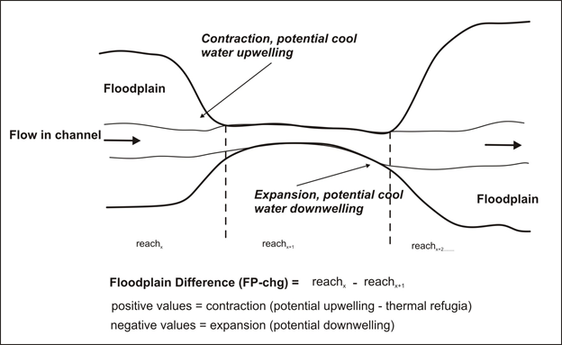
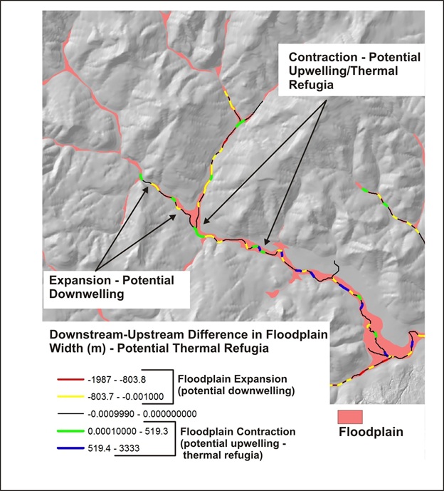
Type 4: Floodplain Upwelling
Figure 1. Floodplain expansion and contraction can promote the upwelling of cooler water and the downwelling of water. Note, the width of floodplains, terraces or valley floors must first be calculated using NetMap's Floodplain Tool. Floodplains are generally mapped at 2x (e.g., two times bankfull depth) although terraces and higher elevation valley floors can also be used (by using > 2x, such as 3x, 4x, and 5x etc.). The "Floodplain Difference" parameter is calcuated by subtracting the downstream floodplain width (reach attribute) from the next upstream width value (see Figure 1). Positive values denotes a width contraction and thus the potential for upwelling and cooler water conditions (refugia) while negative values denotes a width expansion and thus potential downwelling. See examples below.
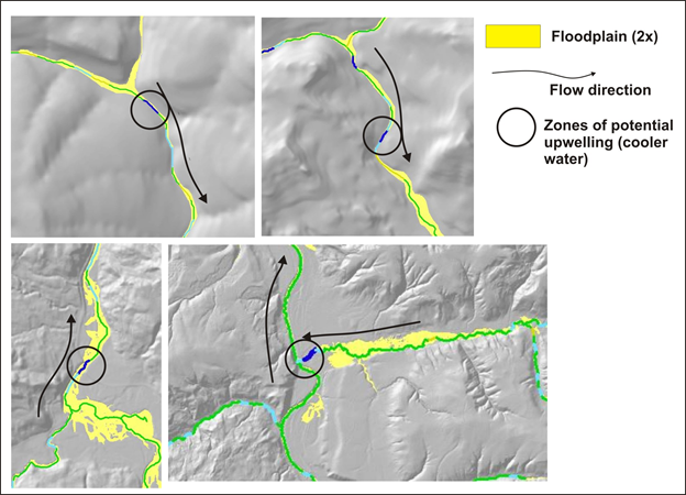
Figures 2 and 3. Examples of floodplains at 2x expansions and contractions and thus denoting the locations of provisional upwelling and downwelling areas.