TODO: To change the footer's content go to Dr.Explain menu Options : Project Settings : HTML (CHM) Export : Setup HTML Template and Layout
Road Stability
Model Description:
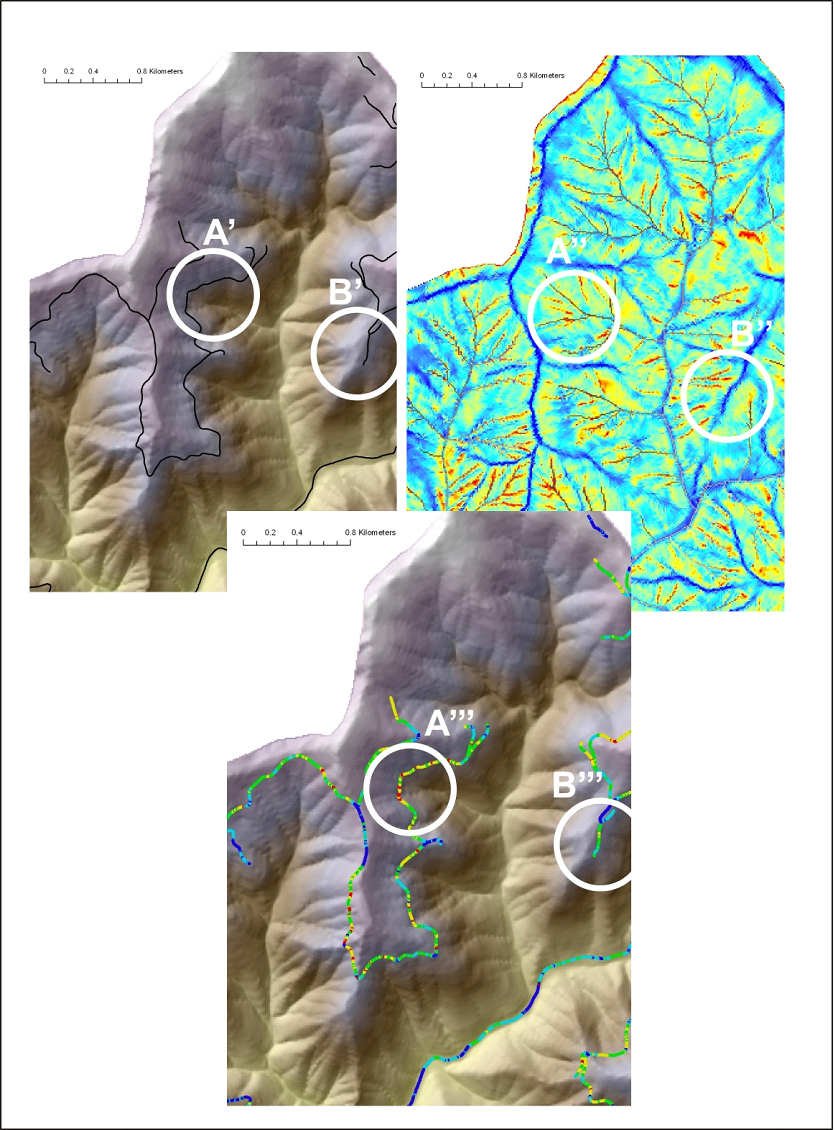
A user selects a hillslope attribute to correlate with road crossings, such as Shallow Landslide Potential and Generic Erosion Potential (GEP). Roads are cut at pixel cell boundaries; see Drainage Wings. All road cells are ranked according to the hillslope ratings for erosion potential (that portion of the hillslope that underlies the road segment) (Figure 2). NetMap does not know about the stability of the road prism itself; this must be obtained from field analysis.
Figure 1. NetMap’s Road stability tool is used to identify where roads intersect hillslope areas of potential stability concern, using parameters such as shallow landslide potential, generic erosion potential, and deep-seated landslide terrain. The road network, discretized at the scale of pixel cells, is overlaid onto the erosion potential map and individual road pixels are classified accordingly. Roads crossing high hazard areas (A’, A’’, A’’’) and crossing low hazard areas (B’, B’’, B’’’) are identified.