TODO: To change the footer's content go to Dr.Explain menu Options : Project Settings : HTML (CHM) Export : Setup HTML Template and Layout
Habitat Length above Roads
Model Description:
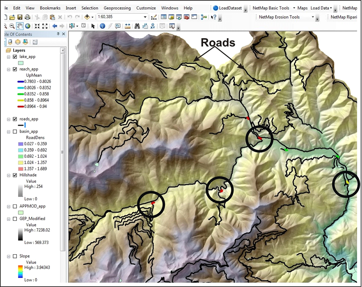
NetMap has the ability to summarize information in stream reaches (as well as on hillslopes, drainage wings and buffers, see Tool) both upstream and downstream. In this version of the tool, a user can calculate the cumulative habitat length, average quality and summed quality, above all road crossings. This type of data analysis may be useful for strategically planning road surveys or road restoration efforts including improving fish passage at road crossings
Figure 21 Shown is the display for average habitat quality (steelhead) above all road crossings.