TODO: To change the footer's content go to Dr.Explain menu Options : Project Settings : HTML (CHM) Export : Setup HTML Template and Layout
Landslide Potential
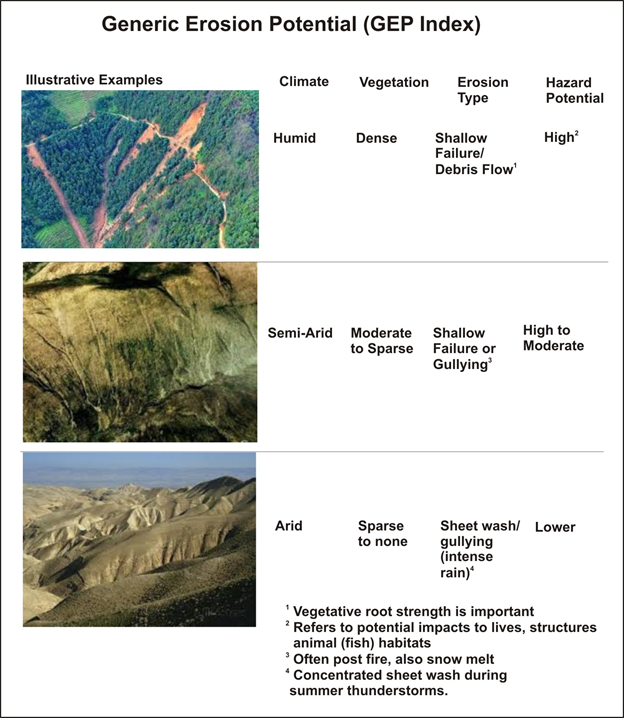
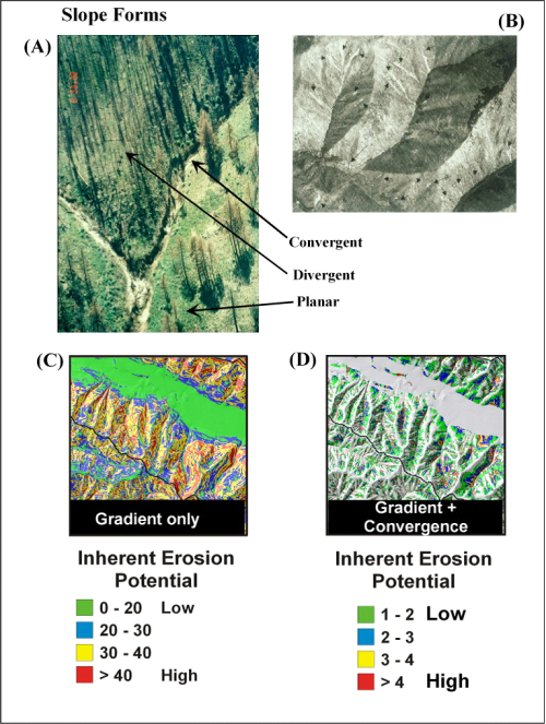
Generic Erosion Potential (GEP), based on slope steepness and convergence, represents the potential for at least three different types of erosion and hazards (see Figure below).
Figure 2. Steep, convergent areas in many landscapes are prone to various forms of erosion including (A) gullying in semi-arid areas, particularly following fires and (B) shallow failures in humid landscapes. Hillslopes can be categorized into (A) convergent, divergent, and planar forms. Slope gradient alone (C) can be used as an approximate indicator of erosion potential since all forms of erosion are strongly governed by slope. A more accurate predictor of erosion potential is slope combined with a measure of topographic convergence to create an intrinsic index of erosion potential (D). NetMap’s GEP index that uses both slope and convergence provides a useful screening of erosion potential across large areas (Figure 2).