TODO: To change the footer's content go to Dr.Explain menu Options : Project Settings : HTML (CHM) Export : Setup HTML Template and Layout
Floodplains
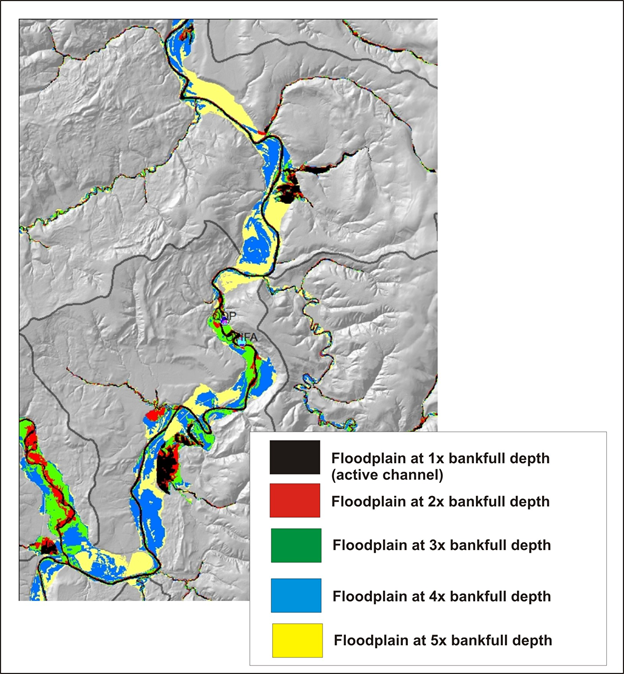
Figure 1. Floodplains mapped at elevation above the channel equivalent to numbers of bank full depths. Generally, 2 - 3 times bankfull depth equals the modern floodplain.
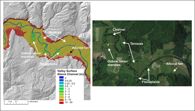
Figure 2. Valley floor mapping of terraces and fans.
.
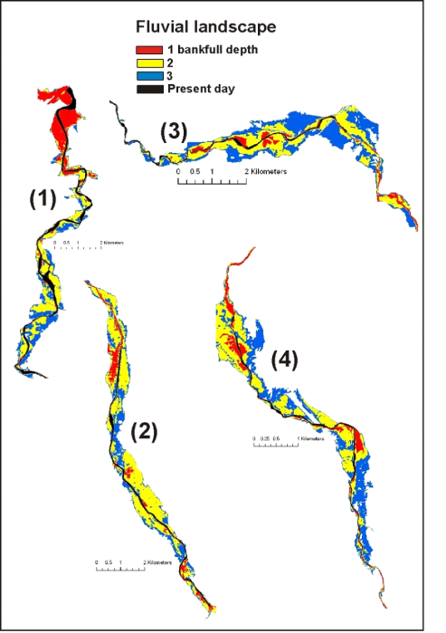
Figure 3. An example of how NetMap’s floodplain mapping tool can be used to examine variable floodplain surfaces using a range of bankfull depths above the channel (e.g., 1 x bankfull depth, 2x, and 3x etc.). Shown above is the present day (diked and regulated) channel in a basin in Northern Spain with NetMap’s predicted floodplains shown at 1x, 2x, and 3x bankfull depths. NetMap was used to develop a catchment scale perspective for river restoration in Spain (http://www.hydrol-earth-syst-sci.net/15/2995/2011/ ).
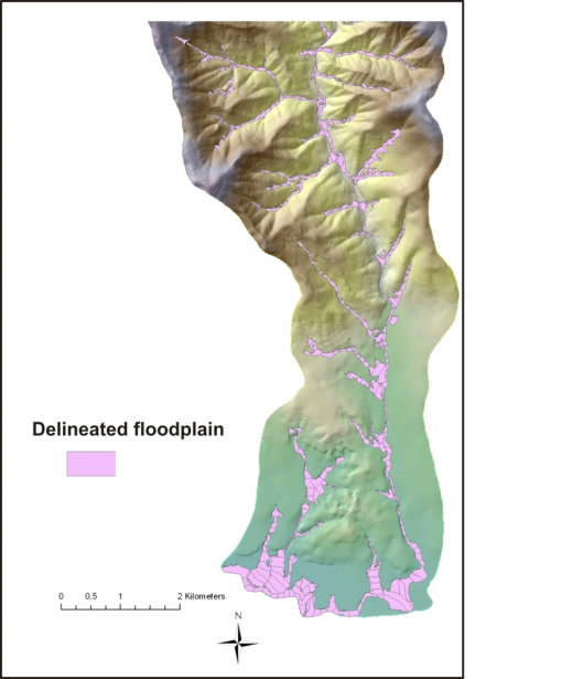
Figure 4. NetMap identifies the extent of the floodplain (differentiates between left and right sides of channel) based on user defined bankfull depth(s) above the channel or based on an absolute elevation above the channel.