TODO: To change the footer's content go to Dr.Explain menu Options : Project Settings : HTML (CHM) Export : Setup HTML Template and Layout
Channel Hydrualic Geometry
Includes:
-bankfull width
-bankfull depth
-reach gradient
-flow velocity
(other useful parameters include drainage area, elevation, azimuth)
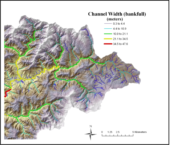
Figure 1. Channel width is important for interpreting channel types, valley confinement index (i.e., valley width/channel width) and fish habitat potential. It is estimated in NetMap using empirical relationships between channel hydraulic geometry and flow discharge and/or average annual precipitation.
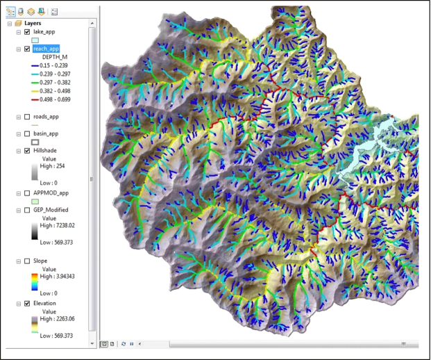
Figure 2. Channel depth is important for assessing various attributes of watersheds including mapping floodplains.
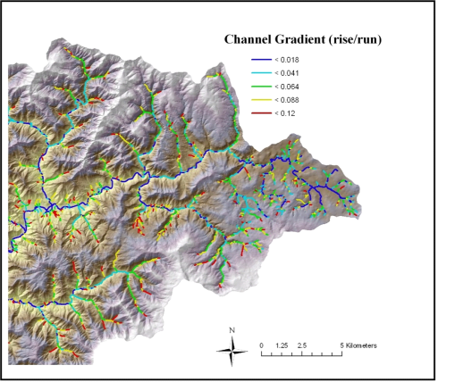
Figure 2. NetMap is used to calculate channel gradient across the channel network.