TODO: To change the header's content go to Dr.Explain menu Options : Project Settings : HTML (CHM) Export : Setup HTML Template and Layout
Menu
Index

Historical Floodplains


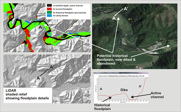
Figure 1. NetMap's floodplain mapping tool, particularly using high resolution LiDAR DEMs, can be used to identify the current floodplain and historical floodplains, now abandoned due to diking, stream cleaning, agriculture and channel incision; analysis in this figure uses 2.5 m LiDAR in the Nehalem watershed in northwestern coastal Oregon.
 
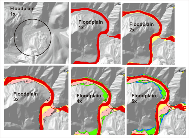
Figure 2. Floodplains at 3x to 5x may indicate abandoned floodplains, including by dikes and channel incision.
The online help was made with Dr.Explain