TODO: To change the footer's content go to Dr.Explain menu Options : Project Settings : HTML (CHM) Export : Setup HTML Template and Layout
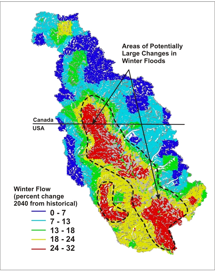
Winter Flow Change
Predictions in NetMap Portal are reported in percent (%) change from historical (1916-2006) to forecasts in 2040 (positive and negative values) available from the Climate Impacts Group at the University of Washington. Although the raw data are in grid form, NetMap converts those values to channel segment values.
Climate change attributes in NetMap Portal can be used to quickly search for landscape vulnerability to climate change by examining intersections among climate change, wildfire risk, and in-stream habitat and channel sensitivity indicators (using any percentile of the distribution).
The scenarios represent a composite average of ten global climate models (GCM) for the western US using four bracketing scenarios based on four GCMs (ECHAM5, MIROC_3.2, HADGEM1, and PCM1). Predictions are for one greenhouse gas scenario (A1B, a middle of the road scenario for future emissions). Results are in percent change from historical (1916-2006) to forecasts in 2040. For additional background information on how forecasts were made, see here and here.
If these attributes are not available for your own watershed, please contact us. See more.
Predicted percent change in summer flow (discharge) in 2040 from historical conditions in the Flathead River basin, Montana/British Columbia.