TODO: To change the footer's content go to Dr.Explain menu Options : Project Settings : HTML (CHM) Export : Setup HTML Template and Layout
Road Density, Upstream Average
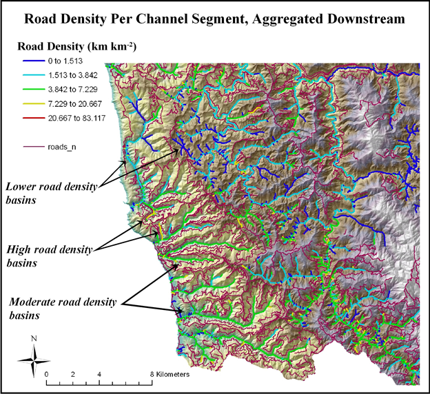
Field name = [RdDensDown]
Typically, road density (km/km2, mi/mi2) is calculated at the scale of watersheds, small to large. In NetMap, road density is calculated at the scale of individual stream segments (50 - 200 m); the length of roads that occurs in local contributing drainage areas (e.g., drainage wings) is divided by the area of the wings, averaging ~0.1 km2. Road density per channel segment is than averaged downstream, providing a cumulative value of road density at any spatial scale defined by the channel network, from the bottom of a first-order headwater channels to the bottom of larger rivers.
This provides a much higher resolution of variation in road density, that can be used as a proxy for impacts. However, NetMap's other more detailed road analyses that includes road hydrologic connectivity, road erosion and sediment delivery, road stability, habitat length above road - stream crossings and roads in floodplains may be more useful compared to road density. If these attributes are not available for your own watershed, please contact us. See NetMap's full online Technical Help.