TODO: To change the footer's content go to Dr.Explain menu Options : Project Settings : HTML (CHM) Export : Setup HTML Template and Layout
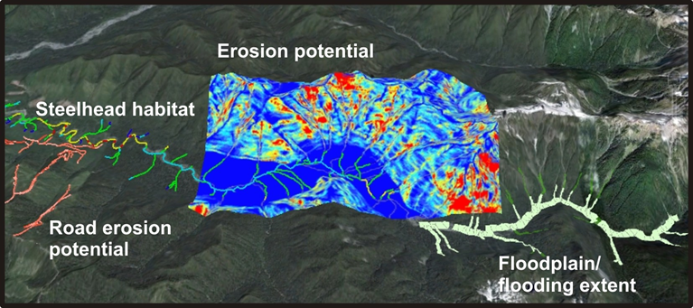
Hillslope Attributes Displayed in Streams
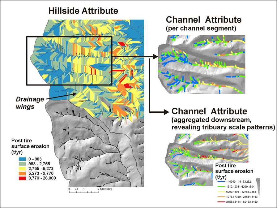
In addition to fluvial and aquatic habitat attributes, stream channels also contain hillside attributes, like erosion potential, wildfire, road characteristics.
Why? Because it offers a channel-eye or fish-eye view of hillside conditions that are relevant to stream conditions and aquatic habitats. For example,
in the Portal's 'Watershed Analyst' module, you can search for and identify locations in the channel network where the highest potential for increased
shade overlaps spatially with the most senstive fish habitats. Or, where the highest erosion potential overlaps with the best quality habitats.
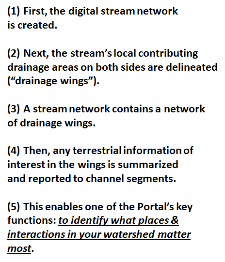
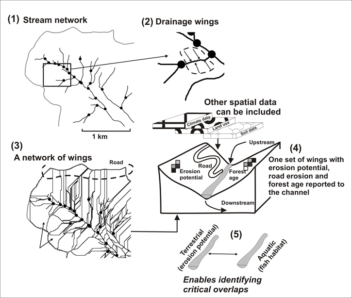
How? Each 100 m stream segment in NetMap's Virtual has its local drainage area on both sides of the
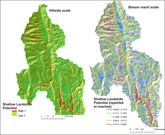
channel delineated (up to ridge tops); we refer to these as "drainage wings". Any spatial data locatined within the local drainage areas can be summarized and reported to the stream channel, creating a fish-eye view of terrestrial attributes. See below for an example. Learn more about “virtual watersheds”.