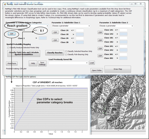
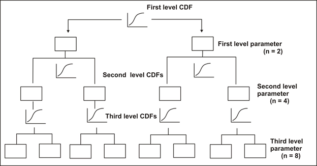
Figure 2. The CDF module in the Parameter Nesting interface aids in setting class breaks.
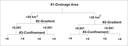
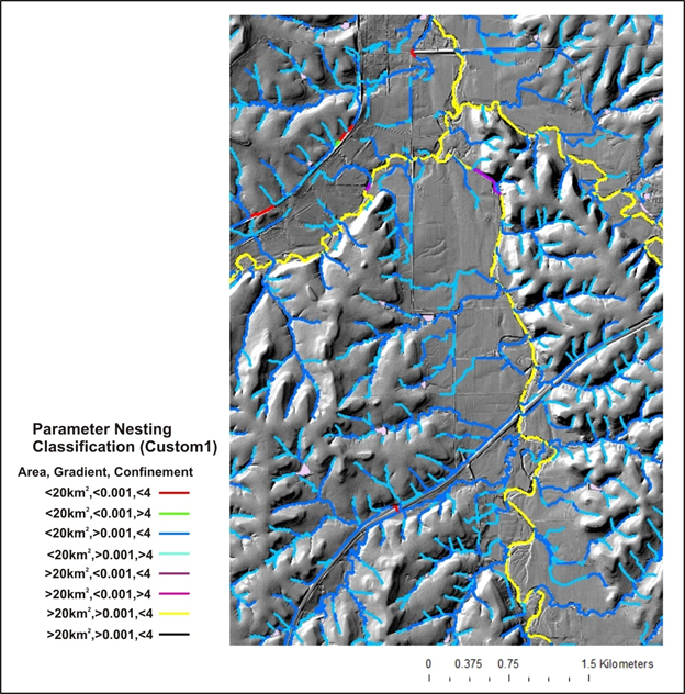
Figure 3. An example of parameter nesting classification in Kansas. See the full classification report here.
Background
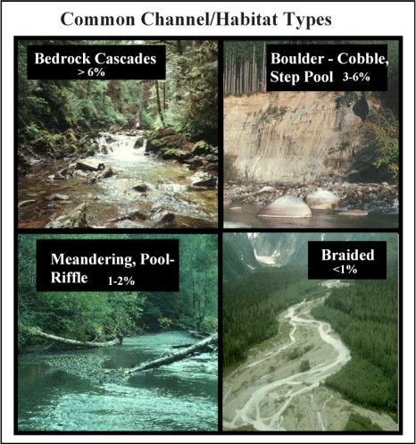
Channel size and gradient are generally correlated (narrow channels tend to be steeper) (Leopold et al. 1964) so that gradient alone provides a useful measure for delineating channel types. Common channel types include bedrock–boulder cascade, boulder-cobble step pool, meandering pool and riffle, and braided (Figure 5). For example, meandering pool and riffle channels are often located in channels less than 2% gradient. Boulder and cobble floored, step pool channels generally range in gradient from 2 to 4%, and cascade channels are often in excess of 4% (Grant 1990).
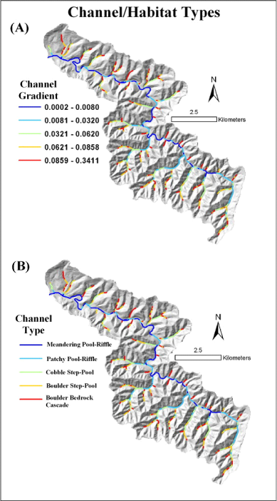
Figure 4. Estimates of channel gradient, valley confinement, and wood accumulations can be used to infer different channel types that are important to aquatic habitats. NetMap creates maps of channel gradients (Figure 6, A); the user can infer channel types using existing stream classification systems (e.g., Montgomery and Buffington 1997, Rosgen 1995) or based on site-specific field observations (Figure 6, B). Regionally specific channel classification systems can also be used, for example in southeast Alaska (Paustian 1992). Inferring substrate sizes is more difficult because of confounding factors that include lithology, wood accumulations, and disturbance history. Field recognizance (or the use of other databases) is recommended when linking particular channel gradient classes with substrate sizes to the overall environmental context of the channel (i.e., confinement, wood accumulations, and bedrock controls, etc.).
Figure 5. Channel gradient (A) can be a good proxy for different channel types (B), the relationship here shown in a 5th-order basin in the Oregon Coast Range. Other information such as wood accumulation types, valley confinement, near-stream topographic roughness, and erosion potential should also be used to delineate channel types. Use of aerial photography and field surveys is recommended.