| < Previous page | Next page > |
MAPS (display)Map Generator
NetMap Module/Tool: Basic Tools/Maps
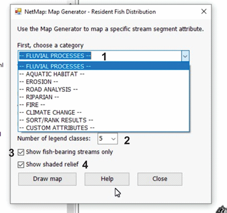
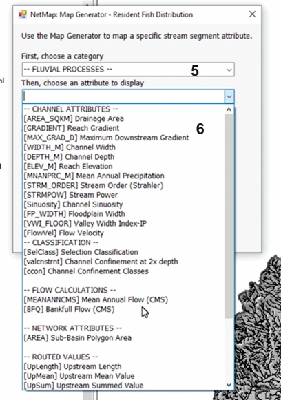
All NetMap attributes can be displayed and viewed using NetMap's map generator. (1) A drop down list displays the map categories, arranged according to NetMap's tool modular add-ins, specifically Fluvial Morphology, Aquatic Habitat, Erosion, Road Analysis, Riparian Management and in addition, Sort and Rank (subbasin classification) results and Custom Attributes. (2) The number of legend categories is selected (default = 5). (3) A user can elect to show only the fish bearing portion of the network, as defined by the user. (4) The shaded relief image can be turned on or off. Once a attribute category has been selected (5), a user selects an attribute from the drop down list, under each category (6).
  |