| < Previous page | Next page > |
6.5 Roads in Floodplains92
Roads in Floodplains
Parameter Description: NetMap’s tool identifies the locations of all roads in floodplains; floodplain extent is predicted by NetMap’s floodplain mapping tool.
Data Type: road (line)
Field Name: roadx; Common name: Road layer
Units: na
NetMap Module/Tool: Roads
Model Description:
NetMap contains a tool for identifying road segments that are located within predicted floodplains; the Floodplain Mapping Tool needs to be run first. See Figures 1 – 3.
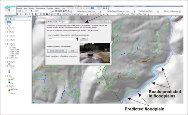 Figure 1. A user needs to select the floodplain polygon (1) from which to identify road crossings within them. Multiple floodplain widths can be used (e.g., 1x, 2x, 3x and 4x bankfull depth elevation above the channel). See also Figures 2 and 3.
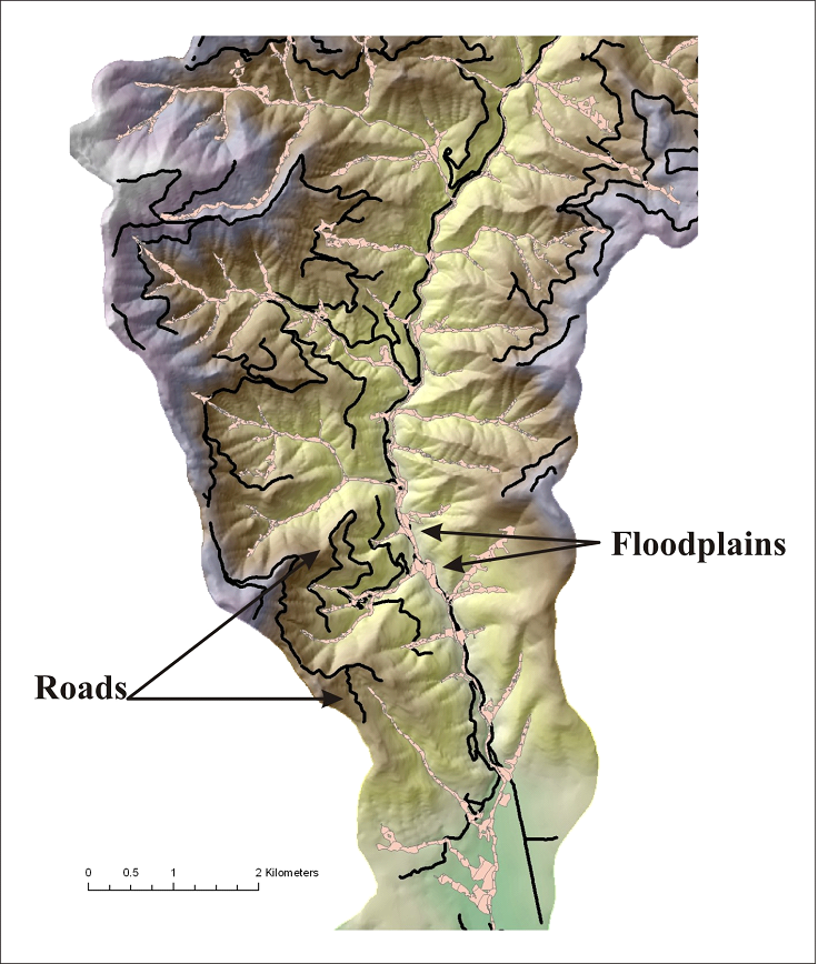 Figure 2. Locations of roads and floodplains are displayed in a basin located in northern California.
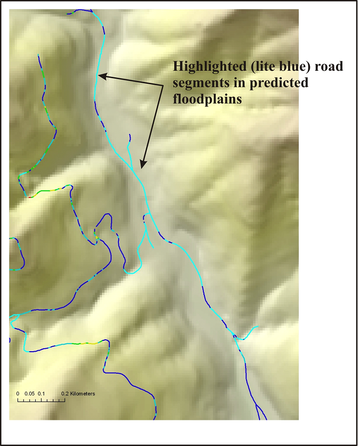 Figure 3. The road segments that may be located within floodplains are highlighted (in light blue). The identified road segments (which should be field verified) could potentially be sources of sediment to streams (see Road Surface Erosion Tool) as well as impinging on channels and limiting migration. Road restoration programs could target such areas.
|